Customize Consent Preferences

We use cookies to help you navigate efficiently and perform certain functions. You will find detailed information about all cookies under each consent category below.

The cookies that are categorized as "Necessary" are stored on your browser as they are essential for enabling the basic functionalities of the site. ... 

Always Active

Necessary cookies are required to enable the basic features of this site, such as providing secure log-in or adjusting your consent preferences. These cookies do not store any personally identifiable data.

No cookies to display.

Functional cookies help perform certain functionalities like sharing the content of the website on social media platforms, collecting feedback, and other third-party features.

No cookies to display.

Analytical cookies are used to understand how visitors interact with the website. These cookies help provide information on metrics such as the number of visitors, bounce rate, traffic source, etc.

No cookies to display.

Performance cookies are used to understand and analyze the key performance indexes of the website which helps in delivering a better user experience for the visitors.

No cookies to display.

Advertisement cookies are used to provide visitors with customized advertisements based on the pages you visited previously and to analyze the effectiveness of the ad campaigns.

No cookies to display.

Excavations.ie

2025:010 - Carrickmines Great, Dublin

NMI Burial Excavation Records

County: Dublin

Site name: Carrickmines Great

Sites and Monuments Record No.: N/A

Licence number: 25E0094

Author: Catriona Baldwin

Site type: Fulacht fiadh

Period/Dating: Prehistoric (12700 BC-AD 400)

ITM: E 721475m, N 723174m

Latitude, Longitude (decimal degrees): 53.245023, -6.179913

Missing Mapbox GL JS CSS

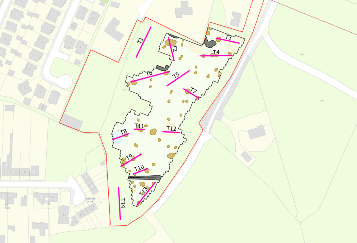
Archaeological testing took place over 2 days from 4 February 2025. The purpose of the programme of archaeological testing was to establish if the anomalies identified through the geophysical survey are archaeological or are due to modern disturbances as suspected. One trench targeted a potential burnt mound identified in the geophysical survey.

The majority of the anomalies identified in the geophysical survey proved to be either large granite boulders, collapsed or partly collapsed stone drains or patches of manganese-rich soil. However, the testing did reveal an extensive spread of burnt mound material in Test Trench 8. The spread, which was approximately 0.3m deep and comprised of a dark-black brown sandy clay with frequent inclusions of heat-affected stone and charcoal, is thought to be the remnants of a ploughed out fulacht fiadh. No dateable finds or animal bone were recovered from the feature.

No additional archaeological finds, features or deposits were identified across the site during the testing.