2025:485 - Ballymichael, Lissarda, Cork
County: Cork
Site name: Ballymichael, Lissarda
Sites and Monuments Record No.: N/A
Licence number: 25E0245
Author: Tony Miller
Author/Organisation Address: Tooreen, Dunmanway, Cork
Site type: No archaeology found
Period/Dating: N/A
ITM: E 539625m, N 566929m
Latitude, Longitude (decimal degrees): 51.851304, -8.876368
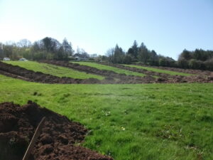
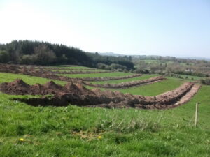
Test excavation was required for an impact assessment for an application for a landfill development at Ballymichael, Lissarda, Cork. The proposed development covered 3.5ha and consisted of a large field of improved pasture on a steep north-west facing slope with two prominent terraces formed by the underlying bedrock. An initial geophysical survey (25R0021) highlighted mostly modern disturbance and agricultural features. 12 test trenches were excavated, all dug down-slope towards the northwest, varying between 250m and 25m in length. A general stratigraphy was recorded over the site of between 0.4m and 0.6m of a mid-brown, loamy topsoil reaching c.1m in depth at the base of slope and just 0.2m on the terraces where the bedrock came close to the surface. The topsoil overlay orange gravelly subsoil with grey marls on the terraces where waterlogging had occurred. Plough marks and drains were noted as well areas of buried modern waste material and soils, especially in a small field on the eastern boundary of the site. No archaeology was found.