2025:479 - Ballineadig, Farran, Cork
County: Cork
Site name: Ballineadig, Farran
Sites and Monuments Record No.: N/A
Licence number: 25E0441
Author: Tony Miller
Author/Organisation Address: Tooreen, Dunmanway, Cork
Site type: No archaeology found
Period/Dating: N/A
ITM: E 550182m, N 570267m
Latitude, Longitude (decimal degrees): 51.882349, -8.723625
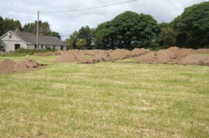
A single dwelling house development required an impact assessment due to its proximity to the recorded position of a standing stone, no longer extant (CO072-106). The development site consisted of a fenced area within a field of improved pasture, located on the summit of a broad ridge between the valleys of the Rivers Bride and Lee. Ten test trenches were excavated over the development footprint, totaling c.200m in length. A general stratigraphy was recorded of between 0.3m and 0.5m of a mid-brown, loamy topsoil overlying orange bouder clay, changing to a hard, grey gravel natural in the northern quadrant of the site. Plough marks and drains were noted in most trenches but no archaeology was found.