2025:440 - CARRIGAPOOKA, Cork
County: Cork
Site name: CARRIGAPOOKA
Sites and Monuments Record No.: CO070-034
Licence number: 25E0141
Author: Enda O Mahony
Author/Organisation Address: Gortageen, Millstreet, Co. Cork
Site type: Castle - tower house
Period/Dating: Late Medieval (AD 1100-AD 1599)
ITM: E 529262m, N 573590m
Latitude, Longitude (decimal degrees): 51.909954, -9.028132
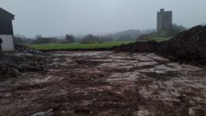
A monitoring licence was required for the proposed construction of a cattle shed and associated ancillary works in the townland of Carrigaphooca in Co. Cork. The site is a green field site and is currently under grass.
The client has applied for planning permission and has received a further information request from the council.
The site was monitored on 17/02/2025, a dry sunny day with occasional heavy showers. The topsoil was removed using a 1.5m-wide grading bucket.
The topsoil was a dry dark brown/black loose peaty/clay with a low density of stone inclusions. Intermixed with the topsoil were pieces of baler twine, bale netting, fragments of plastic and general small pieces of farm waste that had become incorporated into the soil over the years. The depth of topsoil varied across the site but was on average c. 0.3m. The subsoil was a distinct compact light grey clay with a moderate density of stone inclusions. Debris such as twine and bale wrap were noted in the upper 0.1m of the subsoil, presumably driving into the subsoil as a result of rutting/poaching during bad weather and compressed into the soil during rolling. The site had been drained in the past, evident by the three stone-lined drains that were present in the exposed area. The farmer said this part of the field was drained by a herring-bone drainage system with the outlet located in the northern portion of the field.
No archaeological features or deposits were noted in the exposed subsoil.