2025:429 - CAPPAGH, Kinsale, Cork
County: Cork
Site name: CAPPAGH, Kinsale
Sites and Monuments Record No.: N/A
Licence number: 25E0004
Author: David Murphy
Author/Organisation Address: 3a Westpoint Trade Centre, Link Road, Ballincollig, Cork
Site type: Excavation - miscellaneous
Period/Dating: Prehistoric (12700 BC-AD 400)
ITM: E 562820m, N 551030m
Latitude, Longitude (decimal degrees): 51.710415, -8.538002
Two phases of archaeological excavation were carried out at the new Kinsale GAA grounds in Cappagh, Kinsale, County Cork over the course of 2025. The greenfield site is situated on sloping, elevated ground c. 1km northwest of Kinsale town centre.
The Phase 1 excavation cutting measured c. 60m north-south by 45m and was centred over the archaeological features which were revealed in the eastern portion of the overall site during the first phase of archaeological testing (22E0143) carried out at the site in February 2022.
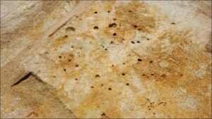
A total of 209 individual contexts including two pyre pits and seven pits containing token amounts of cremated (probable human) bone, a potential four-post structure, as well as numerous other individual pits, post-holes, stake-holes and linear features, along with their associated fills, were fully excavated and recorded within the Phase 1 cutting.
The Phase 2 excavation cutting was located to the west of the Phase 1 cutting and measured 155m (east-west) by 136m. The main concentration of activity, however, was located within a more localised area measuring 65m (east-west) by 25m. Within this area, a total of six probable prehistoric structures and associated domestic and industrial-type features were revealed. During the Phase 2 excavation as a whole, a total of 826 individual contexts were fully excavated and recorded.
The excavated structures were sub-circular to oval in shape and varied in diameter between c. 11m and c. 3m. Their main structural elements consisted of posts which were frequently accompanied by intervening stakes – indicative of wattled outer walling. The larger of the structures (Structure 2 and Structure 4) had evidence for outer and inner post rings, occasional internal pits and stake-holes – likely associated with internal divisions. A number of outlying pit features were also excavated within the cutting; some of these contained evidence of metalworking activity.
Allied with the earlier Phase 1 findings, a comprehensive and complex prehistoric landscape containing evidence of settlement, industrial and ritual activity has now been recorded within the development site. While the evidence currently suggests that this activity dates to the Bronze Age period, this interpretation will remain tentative until the completion of the post-excavation analyses and dating.