2024:604 - BAWNDAW, Carrickphierish Road, Waterford
County: Waterford
Site name: BAWNDAW, Carrickphierish Road
Sites and Monuments Record No.: N/A
Licence number: 24E1194
Author: Barry Lacey, c/o IAC Ltd.
Author/Organisation Address: Unit G1 Network Enterprise Park, Kilcoole, Co. Wicklow
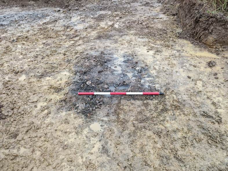
Site type: Pit
Period/Dating: Undetermined
ITM: E 658316m, N 612583m
Latitude, Longitude (decimal degrees): 52.261856, -7.145724
Archaeological testing was carried out on 6 November 2024 in response to a request for further Information by Waterford City and County Council concerning a development on the site. A total of six trenches were excavated across the site measuring 210 linear metres. Two archaeological features were uncovered and designated as Archaeological Area 1 (AA1). The features consist of two pits containing deposits of burnt mound-type material. These remains may be related to other pits uncovered during previous investigations in the vicinity. Evidence of past agricultural and land management activity was uncovered in the form of land drains, a single former field boundary and a plough furrow. The northern portion of the proposed development had previously been disturbed, and modern material was uncovered in the topsoil at this location.