2024:424 - BALLAGHBOY: Red Earl's Road, Sligo
County: Sligo
Site name: BALLAGHBOY: Red Earl's Road
Sites and Monuments Record No.: SL040-190
Licence number: 23E0023
Author: Eoin Halpin, AHC Ltd.
Author/Organisation Address: 36 Ballywillwill Road, Castlewellan, Co. Down, BT31 9LF
Site type: Road - road/trackway
Period/Dating: Late Medieval (AD 1100-AD 1599)
ITM: E 579083m, N 806585m
Latitude, Longitude (decimal degrees): 54.008067, -8.319094
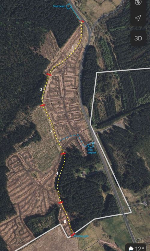
Sligo County Council, in partnership with Coillte, proposed to undertake works on an 900m long section of the existing Red Earl’s Road which until recently ran through Coillte Forestry. It is located some 4km north of Boyle and 2.5km south of Ballinafad. The area had been clear felled with new planting kept well clear of the route of the old roadway. Sligo County Council propose to undertake works on this newly-cleared area, to allow for easier access for walkers along the Red Earl’s Road.
It was proposed to construct a gravel walking trail along the length of the roadway by firstly laying down a 3m-wide layer of heavy duty geotextile matting on top of the present ground surface, with no ground disturbance. A layer of 604 (or similar) gravel will be laid on top of the matting, top dressed with a layer of quarry dust. The geotextile will be laid by hand, with the stone, gravel and quarry dust laid by appropriately small rubber tracked machinery.
The works were overseen by a qualified archaeologist, with the works taking place between July and August 2024. As the entirety of the works were confined to the top of present ground levels, with no element of ground disturbance, there were no impacts on any archaeology associated with the Red Earl’s Road.