2024:874 - Kellystown, Dublin
County: Dublin
Site name: Kellystown
Sites and Monuments Record No.: n/a
Licence number: 24E0565
Author: Liam Coen c/o Courtney Deery Heritage Consultancy
Author/Organisation Address: Nutgrove Office Park, Dublin 14
Site type: Late & post-medieval settlement
Period/Dating: Late Medieval (AD 1100-AD 1599)
ITM: E 705478m, N 737450m
Latitude, Longitude (decimal degrees): 53.376690, -6.414747
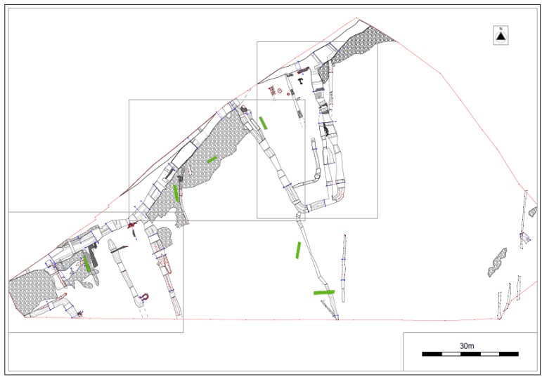
Excavation took place following geophysical survey and test excavation of a greenfield site in advance of development. It revealed the remains of the late medieval settlement of Kellystown, a place associated, in the 17th century if not earlier, with the Luttrell family of Luttrellstown Castle. The settlement evidence took the form of the remains of ditches, pits, cereal-drying kilns, cobbled and compacted yard surfaces & fragmentary sections of walls.
A series of medieval ditches extended alongside the modern north-western field boundary with several others extending off them to form fields or paddocks with one possible trapezoidal enclosure. Extensive areas of cobbling and compacted ground characterized by a dark mineralizing process in the soil indicated the presence of yard areas adjacent to the ditches.
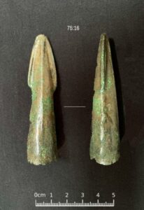
Over 2,500 widely distributed late medieval pottery sherds were retrieved during the excavation, most broadly dated to the 13th and 14th centuries. Numerous other artefacts were retrieved including plough pebbles, sickles, knife blades, nails, buckles, horseshoe fragments, a thimble, a flesh hook and a dress pin. A Middle Bronze Age socketed spearhead was retrieved from a stoney late medieval deposit, possibly a collapsed wall, and its worn nature suggests it may have been reused as an amulet in the medieval period.
Radiocarbon dates sought from two of the kilns and two ditch deposits returned an 8th-9th-century date from the isolated kiln and 13th-14th-century dates for the remainder. The animal bone assemblage revealed mostly cattle, sheep/goat and pigs with the charred cereal remains showed the cultivation of the expected wheat, barley and oats.
Continuity of settlement into the post-medieval period was indicated by the recutting of some of the ditches, principally those running alongside the north-western field boundary. An Edward VI silver shilling (minted 1549) was retrieved from the topsoil while the clay pipe, glass and post-medieval pottery assemblages indicated activity from the 16th-18th centuries. Rocque’s map of the County of Dublin (1760) records a road linking Luttrellstown and Porterstown Castles that appears to run along the line of the modern field boundary. The archaeological ditches with adjacent cobbled and compacted yard areas revealed skirting this modern hedge may indicate the former roadside boundary from the late and post-medieval periods. A cluster of buildings labelled as Kellystown on the Rocque map were recorded on the western side of this road. These buildings and the road were not recorded on the first edition OS map of the 1830’s and their abandonment may be related to the sale of the Luttrellstown estate around 1800.