2023:175 - KINSALE: Church Lane, Townplots, Cork
County: Cork
Site name: KINSALE: Church Lane, Townplots
Sites and Monuments Record No.: CO112-034001-
Licence number: 23E0225
Author: David Murphy
Author/Organisation Address: 3a Westpoint Trade Centre, Link Road, Ballincollig, Cork
Site type: Historic town
Period/Dating: Modern (AD 1750-AD 2000)
ITM: E 563578m, N 550646m
Latitude, Longitude (decimal degrees): 51.707013, -8.526994
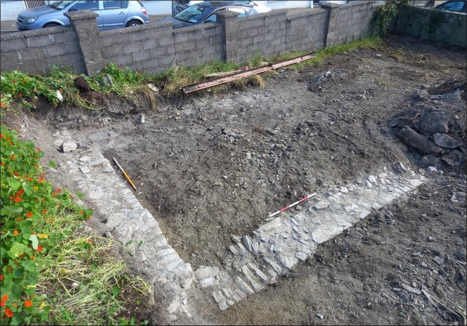
Archaeological monitoring of groundworks at the site of a private dwelling development at Church Lane, Townplots, Kinsale, County Cork was undertaken between 3 and 5 July 2023 in order to comply with a Condition of Cork County Council’s grant of consent. The monitored groundworks consisted of a general reduction to construction formation level across the footprint of the new dwelling, the excavation of a number of shallow foundation trenches, as well as the excavation of a deep trench to facilitate the construction of a retaining wall. No evidence of any activity predating the 19th century was uncovered during the monitoring of the groundworks.
The excavations predominantly extended through modern infill and demolition layers, and occasionally revealed a sterile light yellowish-brown sandy silt subsoil which, in places, had evidently been truncated by previous groundworks undertaken within the subject site. These previous works dated to the 19th and 20th centuries and were associated with construction of a number of now-demolished structures which were built within the site during the 19th century. The foundation remains of the largest of these structures were revealed and recorded in the north-western corner of the site during the monitoring programme. While the excavation of new foundations trenches for the new dwelling necessitated the removal of portions of the southern, western and eastern foundation remnants of the 19th-century structure, significant portions of the 19th-century foundation remnants remain in situ following the completion of the groundworks.