
County: Cork Site name: Proposed Rylane Community Park, Rylane
Sites and Monuments Record No.: CO060-057---- Licence number: 19E0619
Author: David Murphy
Site type: Adjacent to ringfort
Period/Dating: —
ITM: E 542550m, N 581440m
Latitude, Longitude (decimal degrees): 51.982039, -8.836335
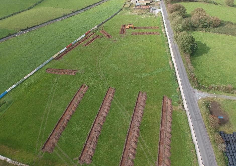
Testing of the site of a proposed community park was undertaken on 7 and 8 October 2019. Fifteen test trenches, measuring 1.8m in width and totalling 575m in length, were excavated across areas of proposed development within the site. Prior to testing, the identifiable external extent of the ringfort (CO060-057----) was mapped by GPS rover and forwarded to the project engineer. As a result, the layout of the proposed park was redesigned to allow for the preservation of the identifiable extent of the ringfort and a surrounding protective buffer area (minimum width of 12m). This area was not impacted during the testing programme and will remain as a green space in the revised plans with proposed development now focused away from the ringfort in the eastern, western and southern portions of the site.
The stratigraphy revealed during the testing programme consisted of 0.25-0.4m of a dark greyish-brown sandy, silt topsoil overlying a varied subsoil which comprised a mix of orangish-brown, purplish-grey and light yellowish-brown stony, clayey silt. The subsoil contained much natural fragmented stone, as well as occasional natural gravel concentrations. Modern disturbance was evident within both the topsoil and upper subsoil with frequent inclusions of modern detritus such as black plastic, metal nails, ceramics etc. evident to the lowest levels of the topsoil. Upcast spoil from the trenches was scanned by a metal detector and a representative amount was sieved, however, only modern items were retrieved. The varied nature of the upper subsoil also indicates soil turbation as a result of past land use practices. While generally sterile, occasional north-east to south-west aligned shallow linear features, likely associated with drainage and/or cultivation, were evident truncating the upper subsoil level, as was evidence of field clearance in the form of burnt root channels. None of this activity was deemed to be of archaeological significance.
John Cronin & Associates, 3 Westpoint Business Centre, Ballincollig, Cork


