
County: Waterford Site name: Woodstown
Sites and Monuments Record No.: WA009-019 Licence number: E4590
Author: James Eogan & Bernice Kelly
Site type: Viking-age settlement
Period/Dating: —
ITM: E 654957m, N 611267m
Latitude, Longitude (decimal degrees): 52.250374, -7.195139
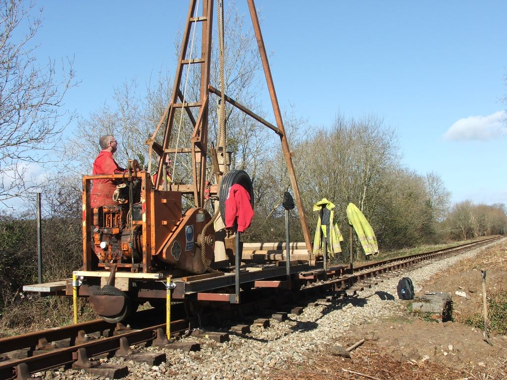
Waterford City and County Council are developing the Waterford Greenway along the route of the former Waterford to Dungarvan railway line. The railway (built in the 1870s) cut through the Viking-age settlement site at Woodstown, discovered during pre-construction archaeological assessment of the N25 Waterford City Bypass (Russell & Hurley 2014). Works associated with the greenway development took place in accordance with a consent issued by the Minister for Arts, Heritage & the Gaeltacht (ref. no. C675). Development of the greenway in the Woodstown area involves the construction of a 3 m wide cycle and pedestrian path adjacent to an existing narrow-gauge railway line operated by the Waterford and Suir Valley Railway. Its construction necessitates the alteration of existing masonry railway bridges where these are too narrow to accommodate both the railway line and the greenway. Two such bridges are located within the confines of the national monument where the railway line crosses two small streams draining directly into the adjacent River Suir. Ground investigations were commissioned adjacent to both bridges. The ground investigations comprised shell and auger boreholes, excavated through the existing railway ballast. The sediments extracted from each borehole underlying the ballast were examined and checked for the presence of any archaeological objects. A metal detector was not used as construction and maintenance of the railway have resulted in a metal-rich environment; due to the small volume of material extracted it was feasible to examine all of the sediments by hand. The boreholes were backfilled with the material extracted from them. Two boreholes were monitored either side of the southernmost bridge (UBP119, ITM 654909, 611176). At 1.9 m below present ground level in the more southerly borehole occasional small fragments of burnt bone and very occasional charcoal flecks were noted in the mid-grey sandy clay. In the second borehole very occasional flecks of burnt bone and charcoal were noted in mid-brown sandy clay 3.3 m below present ground level. Samples were retained of the sediments containing burnt bone and charcoal from each borehole. A third borehole was monitored at the more northerly bridge (UBP120, ITM 654992, 611346). No potentially archaeologically significant deposits were identified in this borehole. It was recommended that construction works associated with the development of the Waterford Greenway be archaeologically monitored. Waterford City and County Council subsequently appointed Archaeological Consultancy Services Unit to carry out this work which was completed in September 2015 under the same excavation registration no.
Reference:
Russell, I. & Hurley, M. F. (2014) Woodstown. A Viking-Age settlement in Co. Waterford. Dublin: Four Courts Press.
Transport Infrastructure Ireland, Tramore House RDO, Tramore, Co. Waterford


