
County: Kerry Site name: Shinnagh
Sites and Monuments Record No.: N/A Licence number: 20E0667
Author: Enda O'Mahony
Site type: Burnt mounds
Period/Dating: —
ITM: E 516476m, N 593040m
Latitude, Longitude (decimal degrees): 52.082981, -9.218664
The site is located just off the N72 at the back of the houses which occupy the main street in the small village of Rathmore in Co Kerry. The entirety of the site was tested during the first two weeks of December 2020. In total the site measured 25 acres or c. 100,000 square metres in size. An average of between 10 to 15% of each field was topsoil stripped. In total 12 fields were archaeologically tested. During the course of the works two burnt mounds were exposed both of which were heavily damaged.
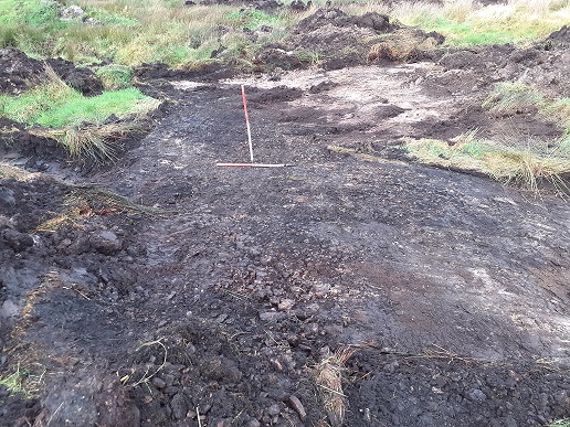
Site A was located on the verge of wet boggy ground to the west and drier ground to the east, at grid reference E516489, N592887. Prior to discovery, the site was walked however no surface trace of the mound was visible. It was exposed at the interface between the peat and the drier ground to the east. Small heat-affected stones together with flecks of charcoal were exposed. The site has been heavily damaged by pervious drainage attempts evident by the gravel grain located just to the east of the mound and a stone drain located at the western verge of the mound. The mound measured 9.5m north-south by 5.2m and had a maximum height of 0.5m. Once the site was recorded the topsoil was reinstated.
Site B is located at grid reference E516651, N592885. Located in the south-eastern quadrant of the field was an area of grass slightly elevated above the surrounding field. The sod was removed to expose typical burnt mound material comprising of heat-shattered stone and flecks of charcoal. A larger area was stripped to reveal the remnants of a levelled burnt bound. The area stripped measured 12.2m north-south by 11.3m. The mound had a maximum height of 0.5 m. The mound is larger than the area exposed however the topsoil removal was beginning to damage the outer limits of the mound so a halt to topsoil removal was called. The mound is dissected by two field drains, one running north-south the other east-west.
Once recorded the area was reinstated.
Gortageen, Millstreet, Co. Cork


